
Services 02
Surveying & Mapping
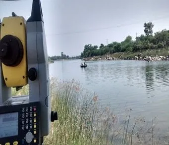
Every design we produce starts with the ground. Our survey teams use conventional and satellite-based equipment, and airborne sensors, to record natural and man-made features with accurate positions and elevations.
Capabilities
Ground Surveys
Our field teams establish control and record every feature that matters to the design. Surveys are tied to a reliable datum so that design, setting out and construction all work from the same reference.
- Topographic surveys with total station
- DGPS control surveys and benchmark establishment
- Digital levelling and longitudinal and cross sections
- Setting out of alignments and structures
- Contour mapping at agreed intervals
Aerial & LiDAR Surveys
Airborne sensors cover large areas in a fraction of the time of a ground survey. LiDAR sees through vegetation to the bare earth, producing detailed terrain models for design and volume calculations.
- Drone (UAV) photogrammetric mapping
- LiDAR surveys and point cloud processing
- Digital terrain and surface models
- Volumetric surveys for earthworks and stockpiles
Selected projects
All projects Surveying work we have delivered
- Push box structure for NH at MadikeriGeotechnical investigation, topographic survey and design for NH-KPWD
- Push box structure across NH-4, HaveriGeotechnical investigation, topographic survey and design for KNNL
- Push box structure across NH-48, Hassan–Bengaluru broad gaugeGeotechnical investigation, topographic survey and design for South Western Railways
- Bhima Flank Irrigation project (26,000 ha)Consultancy services for KBJNL, Karnataka
- Tank filling scheme for 64 tanks, BelagaviGeotechnical investigation, topographic survey and design for KNNL
- Hanumanahalli LIS: 6 tanks from the Bhadra river, HonnaliGeotechnical investigation, topographic survey and design
- Multipurpose hydro, irrigation and flood control, KeralaSurvey and investigations
- Six pumped storage projects, Andhra PradeshSurvey and investigations for DPR preparation
- Patratu Thermal Power PlantEngineering surveys
- 5.5 MWp solar plant, Koppal (RT Solar), KarnatakaModule mounting structure design, geotechnical investigation, survey, roads and drains
- Oswal Cotton Mills Limited, BhopalDrone survey for Bosch